Property Record
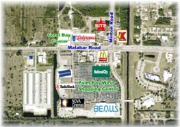
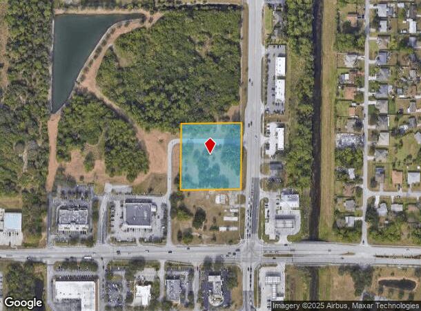
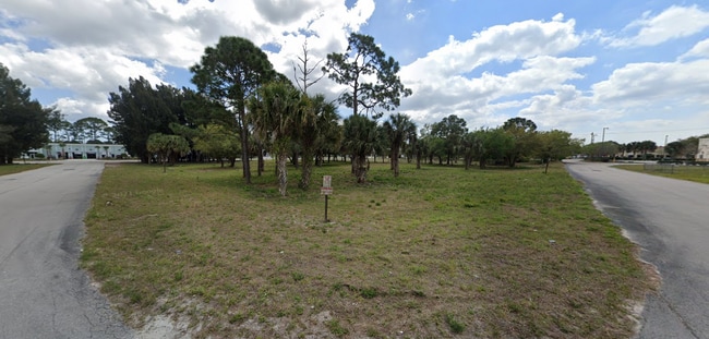
6370 Minton Rd Nw, Palm Bay, FL 32907

Current Lease Availabilities
NEARBY LISTINGS FOR SALE OR LEASE
Property Detail
6370 Minton Rd Nw
28-36-36-00-00758.1-0000.00
N 1/2 OF SE 1/4 OF SE 1/4 OF SE 1/4 LYING W OF NEW MINTON RD EXC RD R/W
Commercialacreage
Brevard
X
Florida
12009C0595G
2.24 AC
2024
Brevard County
2025
Orlando
071351
Palm Bay-Melbourne-Titusville, FL
DEMOGRAPHICS near 6370 Minton Rd Nw
1 Mile
3 Mile
5 Mile
2024 Total Population
8,948
65,870
143,890
2029 Population
9,702
72,336
158,347
Pop Growth 2024-2029
+ 8.43%
+ 9.82%
+ 10.05%
Average Age
40
41
42
2024 Total Households
3,173
24,546
55,669
HH Growth 2024-2029
+ 8.19%
+ 9.62%
+ 9.83%
Median Household Inc
$58,042
$56,482
$60,634
Avg Household Size
2.70
2.60
2.50
2024 Avg HH Vehicles
2.00
2.00
2.00
Median Home Value
$240,916
$214,514
$228,019
Median Year Built
2000
1991
1994
Nearby Places
- Restaurants
- Banks
- Shops
- Fitness
- Groceries
PUBLIC TRANSPORTATION
AIRPORT
Melbourne Orlando International
DRIVE
WALK
Distance
Melbourne Orlando International
21 min
9.4 mi
Freight Ports
Port Canaveral
DRIVE
WALK
Distance
Port Canaveral
54 min
42.6 mi
Nearby Properties
Address
Land Use
TOTAL SIZE
Lot Size
Zoning
Address
Land Use
TOTAL SIZE
Lot Size
Zoning
380,944 SF
32.18 AC
RA
Address
Land Use
TOTAL SIZE
Lot Size
Zoning
391,740 SF
30 AC
Address
Land Use
TOTAL SIZE
Lot Size
Zoning
582,248 SF
65.30 AC
RA
Address
Land Use
TOTAL SIZE
Lot Size
Zoning
321,761 SF
21.27 AC
RM15
Address
Land Use
TOTAL SIZE
Lot Size
Zoning
294,170 SF
70.66 AC
IU
Address
Land Use
TOTAL SIZE
Lot Size
Zoning
307,849 SF
39.14 AC
IU
Address
Land Use
TOTAL SIZE
Lot Size
Zoning
257,044 SF
14.99 AC
Address
Land Use
TOTAL SIZE
Lot Size
Zoning
276,936 SF
18.44 AC
RM20
Address
Land Use
TOTAL SIZE
Lot Size
Zoning
260,331 SF
9.90 AC
RM10
Address
Land Use
TOTAL SIZE
Lot Size
Zoning
188,927 SF
17.97 AC
CP
Address
Land Use
TOTAL SIZE
Lot Size
Zoning
267,548 SF
23.10 AC
RM10
Address
Land Use
TOTAL SIZE
Lot Size
Zoning
97,093 SF
20.87 AC
Address
Land Use
TOTAL SIZE
Lot Size
Zoning
290,105 SF
30.94 AC
CC
Address
Land Use
TOTAL SIZE
Lot Size
Zoning
216,692 SF
28.97 AC
CC
Address
Land Use
TOTAL SIZE
Lot Size
Zoning
117,568 SF
28.97 AC
IU
Address
Land Use
TOTAL SIZE
Lot Size
Zoning
195,032 SF
13.26 AC
RM15
Address
Land Use
TOTAL SIZE
Lot Size
Zoning
118,747 SF
11.43 AC
RM10
Address
Land Use
TOTAL SIZE
Lot Size
Zoning
106,915 SF
11.01 AC
IU
Address
Land Use
TOTAL SIZE
Lot Size
Zoning
118,084 SF
39.09 AC
IU
Address
Land Use
TOTAL SIZE
Lot Size
Zoning
105,976 SF
18.95 AC
IU
Address
Land Use
TOTAL SIZE
Lot Size
Zoning
86,968 SF
9.86 AC
IU
Address
Land Use
TOTAL SIZE
Lot Size
Zoning
114,600 SF
13.47 AC
CC
Address
Land Use
TOTAL SIZE
Lot Size
Zoning
135,860 SF
15.46 AC
CC
Address
Land Use
TOTAL SIZE
Lot Size
Zoning
132,463 SF
11.89 AC
CP
Address
Land Use
TOTAL SIZE
Lot Size
Zoning
123,275 SF
13.22 AC
IU
Address
Land Use
TOTAL SIZE
Lot Size
Zoning
64,346 SF
2.55 AC
Address
Land Use
TOTAL SIZE
Lot Size
Zoning
150,810 SF
15.11 AC
CC
Address
Land Use
TOTAL SIZE
Lot Size
Zoning
85,125 SF
13.06 AC
C1
Address
Land Use
TOTAL SIZE
Lot Size
Zoning
108,024 SF
15.15 AC
CC
Address
Land Use
TOTAL SIZE
Lot Size
Zoning
57,546 SF
2.48 AC
The World's #1 Commercial Real Estate Marketplace
Connect with us
© 2025 CoStar Group
The information above has been obtained from sources believed reliable. While we do not doubt its accuracy we have not verified it and make no guarantee, warranty or representation about it. It is your responsibility to independently confirm its accuracy and completeness. Any projections, opinions, assumptions, or estimates used are for example only and do not represent the current or future performance of the property. The value of this transaction to you depends on tax and other factors which should be evaluated by your tax, financial, and legal advisors. You and your advisors should conduct a careful, independent investigation of the property to determine to your satisfaction the suitability of the property for your needs.